Trails
You would be reading all day if we talked about every trail and hiking opportunity that Bend Oregon offers. To make it simpler, I will mention a few popular attractions and divide the trails into two categories: trails in town and trails outside of city limits.
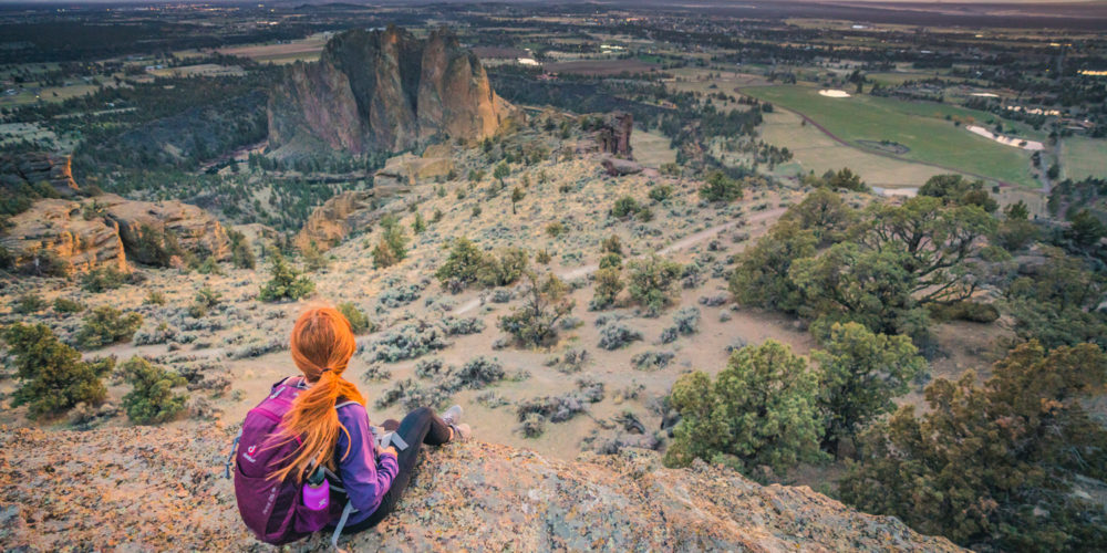
First, there are the out-of-town hiking trails, 20 to 60 minutes away, particularly famous in the summer months (although many are also good for snowshoeing too). These trails explore the many lakes and rock formations in the mountains around Bend. For easy hiking trails near bend, visit Misery Ridge and venture on the misery ridge trail next to the Crooked River located in Smith Rock. For a moderate hike, check out the Green Lake trail or Pacific Crest Trail in the Cascade Mountains located near the Cascade lakes highway. Based on popular opinions, the best hikes in Bend include Broken Top near the South Sister and Mount Bachelor within the Three Sisters Wilderness. Other popular hikes include the panoramic views of Cascade Mountains Range, the lava flow of Newberry National Volcanic Monument, and Smith Rock State Park sites around the city of Bend. The hiking isn’t too arduous but these are usually all-day or half-day adventures – with lots of camping opportunities for bigger fans.
The second category is the trail system within Bend itself. Deschutes National Forest is one of my favorite hikes. The dense forest with flat trails and surrounding landscape makes it easy to hike or go mountain biking with friends. If you’re looking to experience some elevation gain during your bend hike, Mount Washington and Mount Jefferson are great options. For a challenging hike in the high desert, Whychus Creek is a perfect trail. These trails wind around canyons, desert views, rocky river paths, and mountain forests, and are excellent for mountain bikers, casual hiking, or playing with your pooch. They’re fun in both summer and winter months and many merge naturally with nearby parks or neighborhoods, making them easy to find.

Another great resource for information about Bend’s trail system with reviews and tips from hikers is AllTrails. Following is a list of trails in and around Bend, along with their address and distance from downtown:
- Alpine Trail — Mt. Washington/Skyline Park to Tetherow, 3.5 miles
- Big Sky Park Trail — Through Big Sky Park to Neff Road, 0.8 miles
- Brooks-Scanlon Rail Trail — Shevlin Park/Phil’s Trailhead to City of Sisters, 27 miles
- Cascade Highlands Trail — Overturf Park to Phil’s Trailhead, 4.6 miles
- Central Oregon Canal Trail — Reed Market Road to Deschutes River Trail, 3.5 miles
- COCC-Shevlin Park Trail — Mt. Washington to Shevlin Park, 1.8 miles
- Colorado Trail — Haul Road Trail to McKay Park, 1.1 miles
- Coyner Trail — Ponderosa Park to Juniper Park, 0.8 miles
- Deschutes River Trail (North Reach) — Tumalo Road to Tumalo State Park, 3.6 miles
- Deschutes River Trail (Awbrey Reach) — Putnam Road to Sawyer Park, 3.9 miles
- Deschutes River Trail (River Run Reach) — Sawyer Park to First Street Rapids Park, 1.3 miles
- Deschutes River Trail (Pioneer Reach) — First Street Rapids Park to Columbia Park, 2.4 miles
- Deschutes River Trail (Old Mill Reach) — Columbia Park to Haul Road Trail, 3.7 miles
- Deschutes River Trail (South Canyon Reach) — Haul Road Trail to River Rim Park, 4.3 miles
- Discovery Trail — Shevlin Park Road to Skyliners Road, 0.7 miles
- East Bend Canal Trail — 27th Street to East Bend Canal, 1.1 miles
- Haul Road Trail — Bill Healy Bridge to USFS Boundary, 3.3 miles
- Larkspur Trail (North) — US20 Underpass to Stover Park, 2.3 miles
- Larkspur Trail (South) — Larkspur Park to US20 Underpass, 1.8 miles
- North Parkway Trail — Butler Market Road to Empire Avenue, 0.5 miles
- North Unit Canal Trail — Deschutes River to Canal Row Park, 1.5 miles
- O.B. Riley Ranch Reserve — 19975 Glen Vista Road, 1.57 miles
- Pilot Butte Canal Trail — Canal Row Park to Pine Nursery Park, 1.7 miles
- Pine Nursery Park Trail — Pine Nursery Park (Loop Trail), 1.9 miles
- Shevlin Park Area Trails — Shevlin Park (above Canyon and along Tumalo Creek), 9.8 miles
- Sylvan to Summit Trail — Sylvan Park to Summit Park (on Awbrey Butte), 0.6 miles
- Tetherow Trail — Along Tetherow Resort Road, 3.3 miles
- Three Pines Trail — Three Pines Park to Shevlin Commons, 0.2 miles
- West Bend Trail — 17th Street to USFS Road 4606 (Phil’s Trailhead), 2.7 miles


